Te Motu Kairangi/Miramar 2060
landscape design solutions for a challenging future
Landscape Architecture - LAND 411 / 2025 – Te Herenga Waka / Victoria University of Wellington
The project:
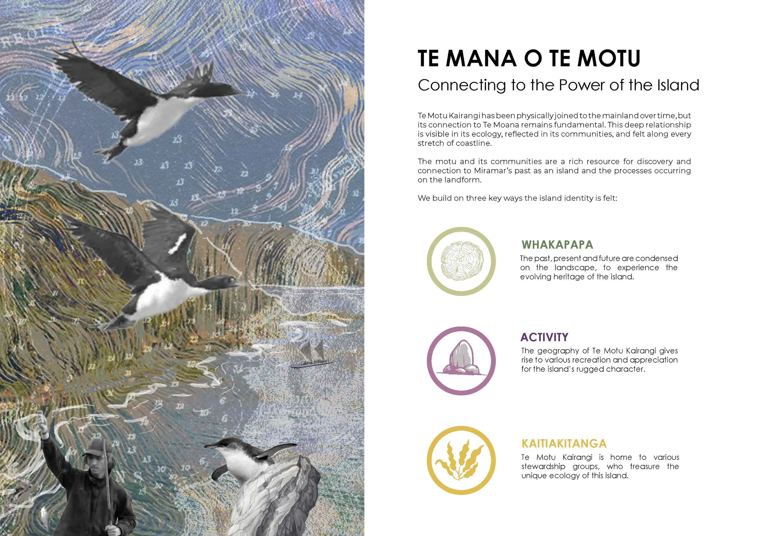
Te Motu Kairangi/Miramar: a highly valuable area to be protected and revealed
Situated in between the Wellington harbour and Cook Strait, Te Motu Kairangi is a piece of land with immense historic value, as it holds Māori significant sites and military emplacements. These are mostly located in areas of the peninsula that have been kept undeveloped, are publicly owned, and are highly valuable for both terrestrial and marine fauna. Due to its location in Wellington harbour, the area also holds a strategic ecological value.
For the last few years, several local community groups have pioneered the stewardship of the area, developing predator suppression, revegetation works or food production initiatives. Combined with these patches of undeveloped land, most of the area is urbanised and presents many anthropogenic pressures. Due to its location, Te Motu Kairangi is highly sensitive to the impact of climate change. Considering its cultural, ecological, and social value, Te Motu Kairangi presents an exceptional opportunity for Wellington City.


An inclusive landscape-based vision for Te Motu Kairangi
The landscape architecture programme of Te Herenga Waka / Victoria University of Wellington has been working on a participatory design project at Te Motu Kairangi that proposes the protection, transformation and expansion of the current reserves present in Te Motu Kairangi, as well as a series of interventions in the urbanised areas considering recreation, mobility, and climate change adaptation. Design proposals aim to be grounded in site knowledge, Mātauranga Māori, and community aspirations. They also aim to be pragmatic but at the same time ambitious. The goal has been to collectively design different Master Plans for the whole area, as well as a wide range of site-specific interventions to gradually transform Te Motu Kairangi.
The idea of the project has been to use the expertise of VUW/LAND 411/2025 students and staff to run a participatory project with the local community, where different voices with different interests and backgrounds have been heard and considered. Many individuals, as well as members of tangata whenua and more than 20 different community groups, have participated in a series of lectures, seminars, workshops, and reviews. The interaction between students and community has been based on principles, values, aspirations, and visions. To facilitate this, two thematic workshops related to environmental, cultural, and social aspects have been organised at Miramar & Maupuia community centre. Each workshop has been designed to have a Māori value underpinning and guiding the discussions between participants.
An expansion of the 2024 project at Mātai Moana/Mt. Crawford
During 2024, the landscape architecture program of Te Herenga Waka /Victoria University of Wellington worked alongside the local community and mana whenua to develop a shared project at Mātai Moana/Mount Crawford. You can see the work done here: https://guerrillamedia.agency/vuw-soa. This project is alive. We are currently working on releasing a final consensus design after a final layer of engagement just with the Taranaki Whānui.
2025’s project has been envisioned as an expansion of last year’s, extending it to the entire peninsula. We have continued focusing on ecological and heritage restoration, as well as recreation and education, but incorporating climate adaptation, envisioning Te Motu Kairangi in 30 years’ time.
If you are not already in the project’s email list and would like to be included and informed about its progress, please email carles.almoyna@vuw.ac.nz
Design objectives:
A gradual transformation of the peninsula:
Conceive a well-documented design framework to be gradually implemented over time;
Include the coastal road, ALL coastal reserves and strategic parts of the urban fabric;
Develop in detail some strategic areas;
Consider natural processes, community engagement, institutional support and economic possibilities;
Construction should be as self-sufficient as possible, considering the involvement of the local community, while associated maintenance costs need to be minimised;
Achieve technically developed small projects to support gradual implementation and economic feasibility;
A new coastal edge:
Facilitate the restoration of coastal habitats by creating a low-traffic environment on the coastal road;
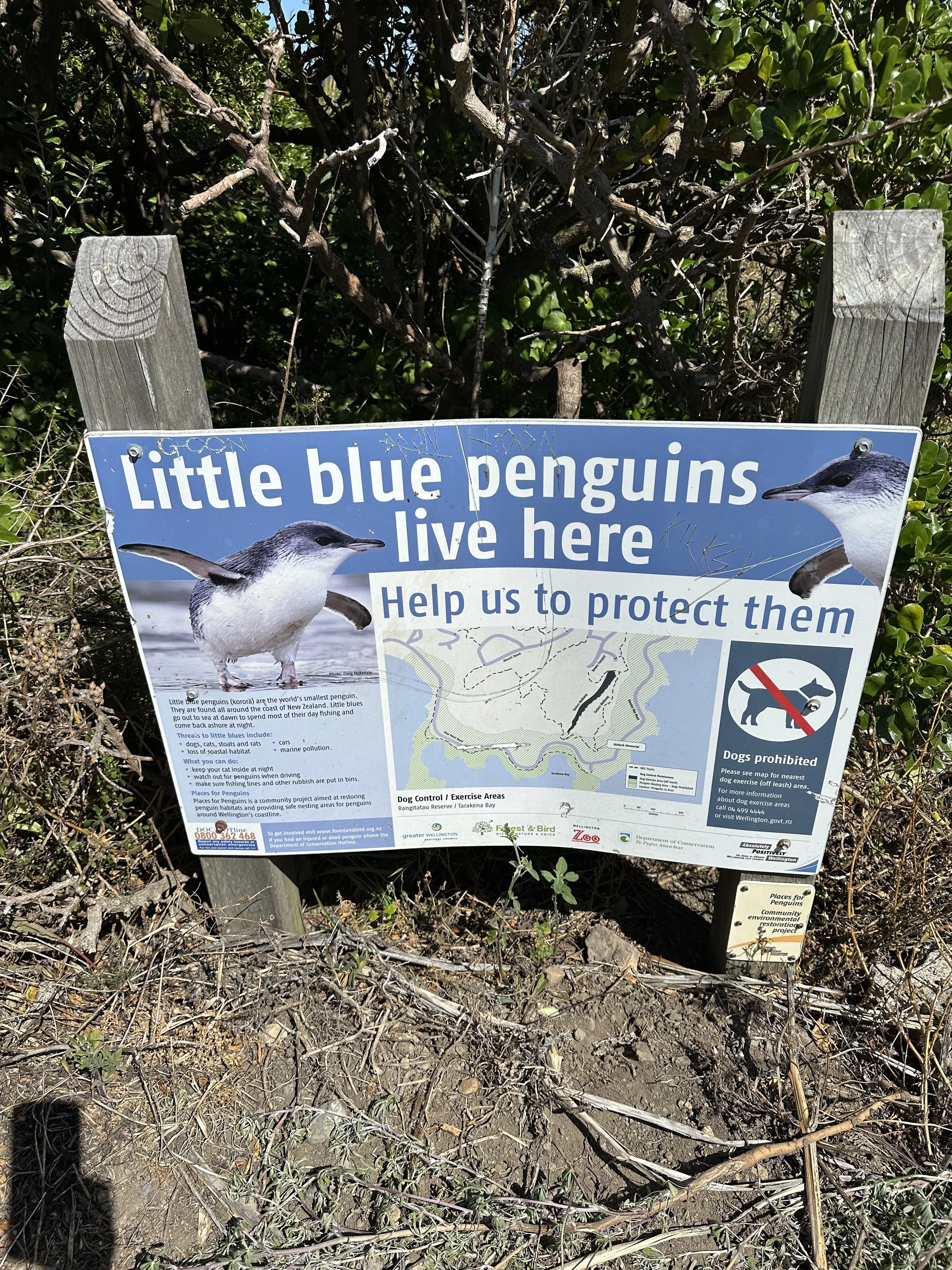
Restore the coastal habitats, targeting particularly marine avian fauna.
Integrate cycling and walking lanes into the coastal edge;
Facilitate human accessibility for fishing and swimming just in key areas of the shoreline;
Protect against predator reinvasion along the road, carparks and coastal entrances to the reserves;
Engage with long-term coastal erosion, longshore drift, daily tides, sudden slides, storm surge, past human interventions and future infrastructure.
Investigate the application of typologies of coastal adaptation responses, including protection (hard and soft), accommodation, ecosystem-based adaptation, or managed retreat;
Plan and design the adaptation of existing infrastructure and buildings; \
Restoration of terrestrial habitats:
Strategize large scale planting in relation to succession, phasing, rare species and biodiversity;
Design against predator reinvasion, with especial attention to the edges of the reserves and public hotspots;
Maximise ecological restoration contemplating accessibility just to public areas and transition zones, leaving inaccessible the areas most ecologically valuable;
Improve the path network, accessibility and permeability:
Protect the highly visible landscape, preserving the open ridgelines for viewing;
Concentrate access to the reserves as much as possible around strategic areas along the coastal road;
Increase accessibility to the heritage sites through an improvement of the existing path network;
Conceive a framework of pathways that facilitate education, landscape experience and access to the key sites;
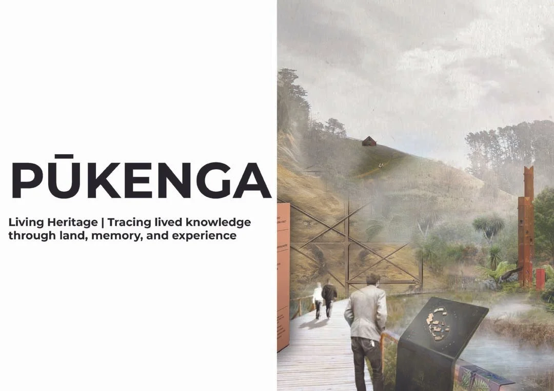
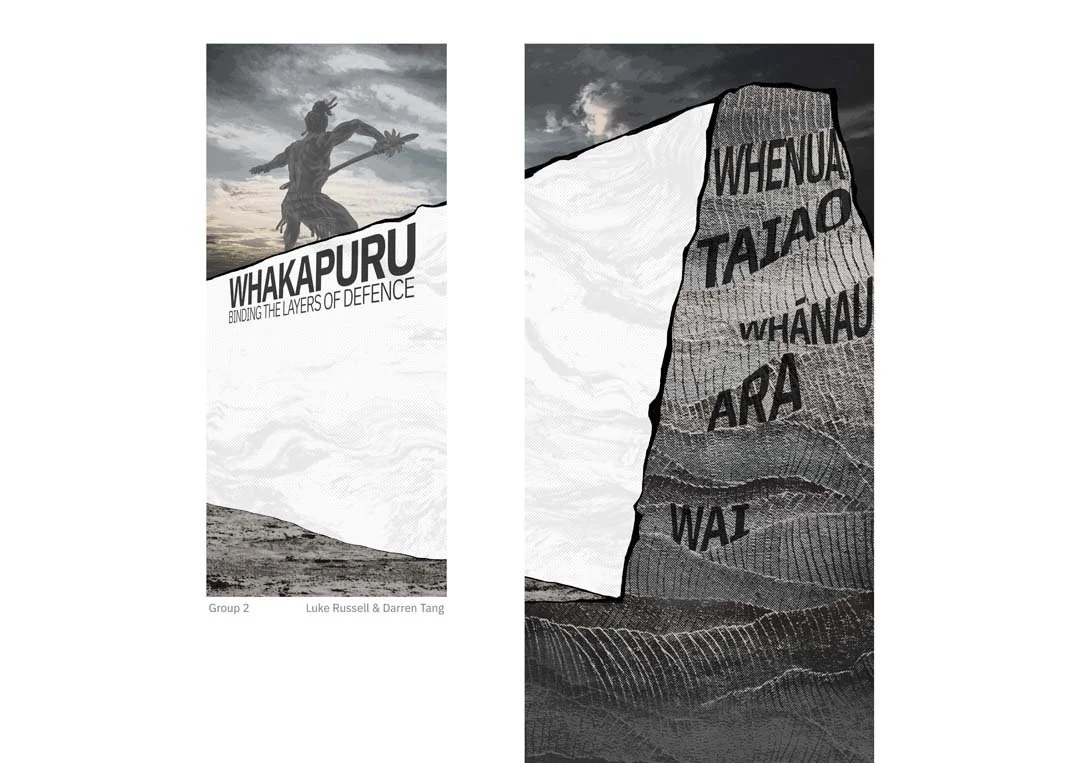
Intervening on heritage:
Interpret and integrate into the coastal reserves the history of the area, protecting and enhancing the intangible and tangible heritage assets of the area (pā, urupā, and kāinga sites, military sites, etc);
Reveal the Māori heritage sites highlighting their significance, contributing to shape culturally related narratives and cultural identity through design;
Restore the military heritage areas and explore the potential reuse of some facilities;
Consider accessibility, safety, spatial qualities, views, materiality, etc…
Learning and education:
Conceive a range of interconnected interventions to educate through sensory and experiential learning;
Integrate ecological restoration, history, cultural heritage, as well as memories and legends as part of the educational experience;
Integrate recreational uses, as well as creative and hospitality uses as part of the educational framework;
The Design process:
The design process was divided into several parts. These were:
Diagnosis:
This first stage was focused on understanding and interpreting the physical, social, and cultural context of the site. It was divided into two parts:
Collective analysis:
Several site visits were organised with local stewards. Considering student preferences, a research topic was assigned to each of them. Individually or in groups (depending on the complexity of the topic), students collected, processed and drew useful information to be shared with the whole class.
Intentioned analysis and initial design strategies:
A series of thematic lectures and seminars with local experts were organized. Students worked in groups. Students started the design process, processing and combining the information collectively gathered and shared. A strong attention to collecting relevant inspirational precedents was given during this stage. The ending goal was to produce an intentioned site analysis and conceive some initial design strategies. Final reviews with representatives of different community groups and mana whenua were organized.
Dreaming:
This stage was based on participation and collaboration, with a strong engagement component. Students continued working in groups.
Participatory design workshops:
Two design workshops were organized and though to be informal and inclusive. Each workshop was thematic (related to environmental, cultural and social aspects), with a Māori value underpinning and guiding the design-based discussions. These were Kaitiakitanga (workshop 1) and Whanaungatanga (workshop 2).
Concept design:
In parallel to the workshops, a series of thematic lectures and seminars with local experts were organized. Considering the inputs received, students produced a series of designs for the whole area, as well as key areas. Reviews with representatives of different community groups and mana whenua were organized.
Defining:
Developed design:
The work done during the conceptual phase was continued to produce a developed design considering site knowledge, Mātauranga Māori and community aspirations. The final designs were developed at a wide range of scales and conceived as a cohesive aggregate of small projects to be gradually implemented over time.
The exhibition:
The exhibition aims to explain the work done and facilitate support for the project. Visitors will be able to provide feedback on the project and the different designs using digital mediums.
Post-exhibition:
This final phase will be used to process the feedback received during the exhibition and facilitate a deliberative process within the community and tangata whenua. The aim will be to develop a final consensus design to inform land protection and the gradual transformation of the area.
If you are new to the project and want to be part of it, please send an email to carles.almoyna@vuw.ac.nz


Exhibition


© 2025 Victoria University School of Architecture. All rights reserved. The intellectual property rights and ownership of all projects, presentations, and works created by students of the Victoria University School of Architecture, as showcased on this website, are retained by the individual student creators. No part of these works may be reproduced, distributed, or transmitted in any form or by any means, including photocopying, recording, or other electronic or mechanical methods, without the prior written permission of the respective student author.
**Disclaimer**
The views, opinions, and statements expressed in the projects and presentations featured on this website are those of the individual student authors and do not necessarily reflect the official policy or position of the Victoria University School of Architecture or its faculty. The University is not responsible for the content of the student works and assumes no liability for any errors or omissions in the information provided. All student works are provided "as is" without any guarantees or warranty.